 |
Mt Sinai, Kadesh Barnea, and the Promised Land: Part Two Posted: 14th October, 2012 |
 |
|
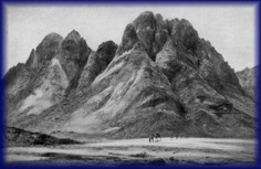
WE ARE NOW READY TO FOLLOW ISRAEL'S TRAIL from Mount Sinai all the way to the Jordan River opposite Jericho going via Kadesh Barnea on the way. We have already discussed the general route taken from Har Kodesh to Kadesh Barnea, and no further comment will be made about it. We will divide our remaining travelogue into three sections: • Kadesh Barnea to Kadesh. Although we can trace the route taken from Har Kodesh to Al Hasa with some confidence, marking the stopovers on a map would be a matter of guesswork. As noted earlier, we do not even know which of the place names in Numbers 33 is one and the same as Kadesh Barnea! The picture begins to change with Moserah, or Moseroth (Num. 33:29), fifteen campsites from Mount Sinai and six stops before reaching Ezion Geber. From Moserah we can make some seriously educated guesses. Figure 11 gives an overview of the circuitous path, split into four stages, taken from Mount Sinai to the Promised Land. Frustration awaits those who seek to figure out logical reasons for seemingly illogical movements. For example, the final leg of the journey to the other side of the Jordan must have taken the Israelites very close perhaps as close as ten miles to their hometown of Kadesh Barnea after taking a very long, circular journey away from Kadesh Barnea. In the early months of their final year on the road, for reasons not explained. they went around in a circle. In a few instances they camped more than once in the same place. The mind of God simply does not lend itself to ready understanding. Some sections will be illustrated in further detail as we proceed. From Kadesh Barnea to KadeshWe'll start with an overview, and then move on to cover this leg in more detail. After spending many years at Kadesh Barnea, Israel received her marching orders: Then we turned and journeyed into the wilderness of the Way of the Red Sea, as the Lord spoke to me, and we skirted Mount Seir for many days (Deut. 2:1). This passage gives us a fairly good idea which way they went, and suggests that they took some years to do it. We have already proposed that the modern Desert Highway lay a little to the east of Edom's eastern border. Since this passage says they skirted Mount Seir for at least part of the journey by taking the Way of the Red Sea (Red Sea Road), we cannot go too wrong to take the Desert Highway as a rough guide to their movements after departing Kadesh Barnea. This route south lay approximately thirty miles west of the route they took to the north from Qurayyah. Numbers 33:35 shows that they eventually went all the way to the Red Sea: They departed from Abronah and camped at Ezion Geber. The next verse adds, They moved from Ezion Geber and camped in the Wilderness of Zin, which is Kadesh. Where was Kadesh relative to Ezion Geber? Was it towards the Arabian Desert in the east, or into the heart of the Sinai Peninsula to the west? Neither. Let's continue in Deuteronomy to clarify what happened at Ezion Geber: And the Lord spoke to me, saying: You have skirted this mountain long enough; turn northward (2:2-3). To recap; when they left Kadesh Barnea they travelled south roughly parallel to the eastern boundary of Edom, eventually arriving at Ezion Geber. Here, God told them to turn northward. They did not retrace their steps back up the eastern side of Edom but now they headed north up the Arabah as hot and desolate an environment as one can imagine along the western side of the Mount Seir escarpment. This scenario fits the fact pointed out earlier that the Wilderness of Zin is to be identified with part or all of the Arabah. In spite of the heat, people lived in the Arabah. We will put up with almost anything to make a dollar. One such settlement was Kadesh, which we have already discussed at length. Miriam died there. Moses and Aaron angered God there. A city stood there. Where was it? Taking as our guide the reasonable notion that cities in the Arabah existed to provide succor and supplies to traders, look for places where trading routes intersected and you will undoubtedly find a town. A trading road ran along the bed of the Arabah from Ezion Geber to the southern end of the Dead Sea and from there into the hill country of Palestine; we will call it the Arabah Road (based on the RSV translation of Deuteronomy 2:8). Somewhere south of the Dead Sea, a branch from this road climbed up to the east to meet the King's Highway (Krahmalkov). No doubt a town, possibly Zalmonah, stood at this fork in the road. Kadesh no doubt stood somewhere along the Arabah Road. But where? Where another trade route intersected it, of course. Archaeologists have been surprised to discover that during the Late Bronze Age the Sinai Peninsula was quite heavily populated, as was the Negev (part of the Promised Land) further north. Traders from the Sinai Peninsula who wanted to take the most economical route east to join the north-south trading roads on the Jordanian plateau would naturally have sought out the easiest ways to climb up and across the Mount Seir escarpment. (The Edomites undoubtedly profited handsomely from taxing merchants.) Towns would have been located where such trails heading east crossed the Arabah Road. As you move north from Ezion Geber you come to just such a pass at about the 35 mile mark. We suggest that Kadesh was located at the intersection near the start of that pass.1 Figure 12 shows all the roads spoken of in this article as well as showing, in blue, the proposed trading trail linking the Arabah Road with the King's Highway. Figures 13 and 14 are Google Earth images illuminating this proposed trail. Figure 13 is a view from Kadesh to the start of the trail, while Figure 14 provides a closeup of the landscape a little way further along. Finally, Figure 15 gives a bird's-eye view of the trail, slightly offset from its actual position to highlight the path, all the way from Kadesh to the start of the King's Highway. The significance of this trail will become evident shortly. The route in detailNow that we have set out the general route from Kadesh Barnea to Ezion Geber to Kadesh, let's flesh it out, beginning with Moserah. Moserah can be identified with Mount Hor by putting two passages together: They moved from Kadesh and camped at Mount Hor, on the boundary of the land of Edom. Then Aaron the priest went up to Mount Hor at the command of the Lord, and died there in the fortieth year after the children of Israel had come out of the land of Egypt (Num. 33:37-38). Now the children of Israel journeyed from the wells of Bene Jaakan to Moserah, where Aaron died (Deut. 10:6). Rejectionists get into a lather over this supposed contradiction about where Aaron died. You don't have to have a PhD in quantum physics to grasp that either Mount Hor and Moserah are two names for the same place, or that Moserah was a township/trading centre located near a peak known as Mount Hor. Mount Hor is traditionally associated with Mt Harun2, located five miles to the west of Petra. This identification faces an insuperable problem: Mt. Harun is located in the heartland of Edom, while the passage above locates it at the extremity of Edom, which is to say right near its border. (See also Num. 20:23.) Not only does the traditional site fail to match the description given, but one cannot begin to imagine that the King of Edom would have countenanced Israelites camping in the vicinity, as Numbers 33:37 shows they did. The simple fact is that traditionalists are searching on the wrong side of the Mount Seir escarpment for Mount Hor. Mount Hor is a peak near the eastern border of Edom, not a peak in the western heartlands. To establish the location of Moserah we need to find a suitable peak east of the escarpment. If our whole thesis contains any weaknesses, it is at this point. By contrast with the rugged escarpment making up the western part of Mount Seir, which provides many peaks that could be labeled mountains, the eastern borderlands of Edom are by and large monotonously flat, extending forever eastwards into the vast Saudi Arabian desert lands. You are hard-pressed to find any peak that can pass as a mountain by our way of thinking. The problem is not, however, intractable. The solution lies in recognizing that a har, in Hebrew, can be practically anything from a knoll to a hill to a majestic peak. Any prominence that juts above its surroundings is a mountain. The word can sometimes best be translated high country, referring not to a specific peak but a plateau. Using the color-by-altitude feature in Natural Scene Designer yields a hillock at 30 12 20 35 36 07 rising a couple of hundred feet above its surroundings. Zooming in on Google Earth shows that this hill has been extensively quarried. It may have originally stood taller in the saddle. Without getting on the ground, it's impossible to judge whether or not this hill looks impressive to human eyes. Though its height leaves a little to be desired, its location shows promise, being situated about five miles west of the Desert Highway (the road to the Red Sea), and about eight miles east of the Kings Highway, complying nicely with the fact that Mount Hor was close to the border of Edom. Though disappointing as this peak may be for those who would prefer God's servant to die on a soaring mountaintop, one piece of internal evidence supports the notion that Mount Hor might better be rendered Hor Hill. It has to do with the circumstances of Aaron's death: Take Aaron and Eleazar his son, and bring them up to Mount Hor; and strip Aaron of his garments and put them on Eleazar his son; for Aaron shall be gathered to his people and die there. So Moses did just as the Lord commanded, and they went up to Mount Hor in the sight of all the congregation. Moses stripped Aaron of his garments and put them on Eleazar his son; and Aaron died there on the top of the mountain (Num. 20:25-28). This passage reads most naturally to suggest that the people were able to witness the entire event rather than watching on as Moses and Aaron disappeared into the mist as they climbed high up a massive peak. Though the author would prefer to picture Hor as a mountain that commands respect, the evidence leads to a different conclusion. We take what we are given. Besides, as any gambler will aver, you would be wiser to put your money on an accessible hillock than an in accessible mountain. Bene JaakanHaving established a location for Mount Hor (Moserah), might we be able to deduce with some degree of confidence where the next stopovers are located? They are, in order, Bene Jaakan, Hor Hagidgad, Jotbathah, Abronah, and Ezion Geber, the location of the last of which on the northern tip of the Gulf of Aqaba is well-attested. The next stop after Moserah is Bene Jaakan. We can deduce its position with a fair degree of accuracy and confidence. Fifteen miles from our Moserah along the Desert Highway (Red Sea Road) is a junction where a road coming from the north-west joins the Desert Highway. This road follows the route of one of the most ancient of roads the famous King's Highway. The King's Highway is part of one long trading route that we spoke of in Somewhere, over the Red Sea. It began in Egypt and crossed the Sinai Peninsula to Ezion Geber. There it was met by the incense road coming from southern Saudi Arabia through Midian, the same road the Israelites used to get to Mount Sinai. From Ezion Geber, the King's Highway combined with the Red Sea Road heading north-east for about 45 miles and then forked off on its own towards the north-west before turning due north and wending its way through Edom, passing through Petra on the way. It then pierced the heart of Canamalia and continued north through Moab all the way to Amman, Jordan (biblical Rabbah). Refer again to Figure 12 for a visual perspective of this explanation. Figure 16 is a photo downloaded from Google Earth taken somewhere along this road exactly where the author cannot say. A settlement at this junction would undoubtedly have served as a major merchants' stopover. The Israelites probably camped as close as was practical to this site. The author conjectures with considerable confidence that another trading path converged at this point the path from Kadesh mentioned earlier used by merchants and travelers from the Sinai Peninsula (Figure 15). It all fits. This junction, Bene Jaakan, may have lain on the southern boundary of Edom in Moses' time, possibly at its extreme south-eastern corner. Reasons for making this statement will come later. Hor Hagidgad, Jotbathah, and AbronahThe Israelites seem to have left the Red Sea Road at Bene Jaakan and headed south and slightly east. On what basis can such a claim be made? One of the most fascinating glimmers of information in the whole account of the wilderness wanderings is associated with Jotbathah. Deuteronomy 10:7 describes it as a land of rivers [wadis] of water. Since no location in that part of the world could possibly enjoy a lot more rain than nearby locations, one must conclude that at least some of the water in this land of wadis of waters must have come from a source other than rain. The only answer can be groundwater. Situated a short two stops before Ezion Geber, one can conclude that this land would most likely have been situated somewhere between twenty and forty miles distant. A Google Earth search does not reveal any luxuriantly-vegetated areas. Evidently, the groundwater supply has dwindled since Moses' time, but must still lie close to the surface. A Google search on water in that region keeps bringing you back to one place: Wadi Rum.3 Judging by the number of photos uploaded on Google Earth, Wadi Rum is more popular as a tourist destination than Petra. The stunning desert scenes in the movie Lawrence of Arabia were filmed here. Did the Israelites spend a few years there towards the latter stage of their forty years of hardship as a kind of consolation for their privations? Its location, some 35 miles from Ezion Geber, fits the bill perfectly for the second last stop before reaching that city. Back to the water. Attayak Aouda, of Wadi Rum Mountain Guides, told the author in a personal communication that, Our water comes from the aquifer at Disseh. In places, and at certain seasons, there is water on the surface, and almost everywhere the water is only a meter or so down. Many wells have been dug, and it is now supplied to south Jordan via pipe lines. Without access to further detailed information it is impossible to be certain that the Disi Aquifer is the source of the water described in Deuteronomy 10:7. However, based on the testimony of the tour guide, it seems logical to propose that cracks in the bedrock separating the aquifer from the surface may have allowed water to percolate all the way to the surface in Moses' day. This idea is supported by the fact that there is a perceptible flow from the Saudi side into Jordan (Shapland 1997, p. 148). Today it doesn't quite get to the surface at Wadi Rum because it is being pumped out faster than it can make its way upwards; one third of the precious resource has already been used up. We can summarize this section by saying that Wadi Rum stands head and shoulders above any and all other candidates within a fifty mile radius of Ezion Geber for meeting Moses' amazing description of Jotbathah. Nothing in the north-east Sinai Peninsula, where Jotbathah would have to be located based on traditional views, comes anywhere as close. My money is on Wadi Rum as the location of Jotbathah. Where you plot Hor Hagidgad and Abronah one on either side of Jotbathah is once again a matter of educated guesswork. We have plotted them on our map purely as a rough guide. Do we have any data to support the general picture presented here as to locations of these wilderness stations? Indeed. Once you have reasonably firm positions for the three stations that mark out the beginning, middle point and end point of the journey Kibroth Hattaavah, Kadesh Barnea and Ezion Geber you can do simple arithmetic. With these three points you can easily measure the total distance walked on this leg of the journey and then divide it by the number of stations to get an average of the distance between stations. Once that is done, you have a control for testing proposed locations. The total distance travelled from Kibroth Hattaavah to Kadesh Barnea to Ezion Geber comes to about 310-330 miles, depending upon where Kibroth Hattaavah is located. (Which itself depends on the length of a day's journey.) Divide this figure by the total number of stopovers (nineteen) yields an average distance between stopovers of 16.3 to 17.4 miles. The theory we have just presented concerning these latter stopovers produces the following distances separating them: • Moserah to Bene Jaakan: 17 miles Our scheme seems perfectly reasonable, wouldn't you say? We cannot consider it proven, but certainly perfectly acceptable. From Abronah they proceeded to Ezion Geber. Deuteronomy 2: 7 shows that their arrival at Ezion Geber coincided with the fortieth year, most likely the first month. From Ezion Geber they went on to Kadesh. Why? Deuteronomy 2:4-6 provides the background necessary to understanding the significance of the stop at Kadesh: You are about to pass through the territory of your brethren, the descendants of Esau, who live in Seir; and they will be afraid of you. Therefore watch yourselves carefully. Do not meddle with them, for I will not give you any of their land, no, not so much as one footstep, because I have given Mount Seir to Esau as a possession. You shall buy food from them with money, that you may eat; and you shall also buy water from them with money, that you may drink. Here God reveals that His original plan for getting them to the Promised Land involved going along the King's Highway through Edomite territory. However, due to Edomite lack of social graces, or just plain belligerence, this plan had to be scuttled, as we will soon see. God undoubtedly had foreseen this outcome, but we will not pursue the questions that such a statement raises. So, on with the show; it's off to Kadesh we go. (Figure 17 shows the proposed route from Moserah to Kadesh in more detail.) From Kadesh to ZalmonahIn order to serve passing merchants, Kadesh must have had access to a water supply; maybe underground cisterns had been constructed for the purpose. It was certainly not adequate, however, for the entire Israelite nation. The dearth fueled conniptions of self-pity and fits of griping among the Israelites when the cloud ground to a halt here. The Holy One of Israel, ever merciful, told Moses what to do. Let Numbers fill in the details: Then the Lord spoke to Moses, saying, Take the rod; you and your brother Aaron gather the congregation together. Speak to the rock before their eyes, and it will yield its water; thus you shall bring water for them out of the rock, and give drink to the congregation and their animals. So Moses took the rod from before the Lord as He commanded him. And Moses and Aaron gathered the assembly together before the rock; and he said to them, Hear now, you rebels! Must we bring water for you out of this rock? Then Moses lifted his hand and struck the rock twice with his rod; and water came out abundantly, and the congregation and their animals drank ( 20:7-11). God had a plan to provide water for them anyway. Such is the way with God. The people were not willing to patiently wait an hour or so for God to reveal His intentions. Such is the way with us. The dispute between God and man here was so intense that God named the place waters of contention. The most challenging part of the entire exercise of reconstructing Israel's movements during its period of postponement (aka wilderness wanderings) begins here at Kadesh. By comparison, the task of reconstruction has been duck soup up until now. Let's put all the difficult passages on the table and see what we can come up with. First, Then the children of Israel, the whole congregation, journeyed from Kadesh and came to Mount Hor (Num. 20:22). Hang on. Are we saying that they left Kadesh and travelled back to Mount Hor (Moserah) where they had camped some years earlier? (Remember, Kadesh is in the Arabah on the west side of Mount Seir, while Mount Hor is on top of the plateau on the east side of Mount Seir.) Yes. That's what it seems to be saying. There Aaron died in the fortieth year after the children of Israel had come out of the land of Egypt, on the first day of the fifth month (Num. 33:38). If our guess that Israel was in Ezion Geber in the first month is correct, Aaron's death at Mount Hor occurred four to five months later. Now stir in Numbers 21:4: Then they journeyed from Mount Hor by the Way of the Red Sea, to go around the land of Edom; and the soul of the people became very discouraged on the way. Hang on. Are we saying that when they left Moserah/Mt Hor they once again headed south towards the Red Sea, circling around the land of Edom once again before finally returning yet again to the Arabah? Yes, that's what it seems to be saying. No wonder the soul of the people became very discouraged on the way. Oh no, not here again! Been here, suffered this. For all we know they had gone full circle and returned to Kadesh. By this time they were hopping mad, and spoke against God and against Moses (Num. 21:5). The result was not pretty (vss. 6-9). Now we need to feed in a couple more verses that have occasioned considerable difficulty. Truth is, they help corroborate the plain yet puzzling words we have just read: Now the children of Israel journeyed from the wells of Bene Jaakan to Moserah [Mount Hor], where Aaron died, and where he was buried; and Eleazar his son ministered as priest in his stead. From there they journeyed to Gudgodah [Hor Hagidgad], and from Gudgodah to Jotbathah, a land of rivers of water (Deut. 10:6-7). This passage is often assailed by biblioskeptics as evidence that the Bible contradicts itself. This passage speaks of the Israelites going from Bene Jaakan to Moserah, while Numbers 33:31 turns the order around. To insist that these accounts are contradictory is to accuse Moses of want of intellect or of tippling. However, when one recognizes the simple truth that the Pentateuch omits much for sake of brevity, one will rejoice whenever additional data is provided to plug into the reconstruction. That is certainly the case here. This snippet from Deuteronomy is not talking about the visits to these places spoken of in Numbers 33 but is talking about a return visit years later, all squeezed into a month or two. In a nutshell, the data shows that they journeyed from Kadesh to Bene Jaakan to Moserah to Hor Hagidgad to Jotbathah, then around the southern end of Edom back into the Arabah (not necessarily going via Ezion Geber again) and possibly back to Kadesh. When these proceedings are plotted on a map it becomes clear why the order of Bene Jaakan and Moserah is the reverse of that given when they passed by years earlier. Figure 18 clarifies this leg of the journey. What was going on? Remember that God had recently told them they were about to begin the final phase of their odyssey, which was to take them through the heartlands of Edom, Moab, and Canamalia along the King's Highway all the way to the Jordan River. To access the King's Highway from Kadesh they would have made their way up the pass to Bene Jaakan where the Highway entered Edomite territory (Figure 12). This plan, however, depended for its success on approval being given by the Edomites and Moabites to travel through their respective territories. We saw earlier that the requests were denied. Let's look at this rejection in a little more detail, as it helps explain the bizarre detour we have just been talking about. When Israel first arrived at Kadesh, in the first or second month of the fortieth year, Moses sent a letter to the King of Edom: Now Moses sent messengers from Kadesh to the king of Edom. Thus says your brother Israel: You know all the hardship that has befallen us, how our fathers went down to Egypt, and we dwelt in Egypt a long time, and the Egyptians afflicted us and our fathers. When we cried out to the Lord, He heard our voice and sent the Angel and brought us up out of Egypt; now here we are in Kadesh, a city on the edge of your border. Please let us pass through your country. We will not pass through fields or vineyards, nor will we drink water from wells; we will go along the King's Highway; we will not turn aside to the right hand or to the left until we have passed through your territory.' Then Edom said to him, You shall not pass through my land, lest I come out against you with the sword (Num. 20:14-18). Talk about twitchy. Talk about rude. The Edomites undoubtedly harbored deep suspicions of possible Israelite skullduggery. Stop and think. You are an Israelite, camped in what you consider a hell hole, waiting for the go-ahead to proceed to your promised inheritance. Your hopes are dashed when the King of Edom rejects your application. Weeks go by, and nothing happens (Jdg. 11:17). Thumb twiddling, rock climbing, and playing rock-paper-scissors quickly lose their appeal. You join a mob to put pressure on Moses to do something. Then someone suggests sending a second letter, this time emphasizing Israel's willingness to pay top dollar for any food and water supplied by the Edomites. Moses acquiesces, and a second letter is sent: So the children of Israel said to him, We will go by the Highway, and if I or my livestock drink any of your water, then I will pay for it; let me only pass through on foot, nothing more (Num. 20:19). This offer is certain to work. Money talks. So sure are you and your fellow stirrers that Old King Edom will relent that you urge Moses to decide, with or without God's approval, to break camp at Kadesh and, while the messengers were toing and froing, head for Bene Jaakan taking the trail mentioned earlier. At Bene Jaakan you wait for an entry visa to be issued. You set up camp near the start of the Highway, making sure not to cross into Edomite territory. As an aside, if this theory is correct, it strongly implies that this trading pathway marked the southern border of Edom in Moses time. If the border were further south, that would mean the Israelites were trespassing on Edomite territory by taking this route. The whole thrust of this episode makes that prospect an impossibility. Disaster strikes. The Edomites may have interpreted your bivouacking so close to the border as a belligerent gesture. Who can say? What happened next was not on your program: Then he said, You shall not pass through. So Edom came out against them with many men and with a strong hand (Num. 20:20). In the panic that ensued, the Israelites fled; for some unstated reason, Moserah was their place of choice. We can speculate that many scattered in other directions, but the bulk of the people ended up there. Did the pillar of cloud lead them at this time, or did the people throw all caution to the wind in the general panic and make their own decisions? Who can say? While at Moserah, Aaron died, and the people stayed there for thirty days to mourn him (Num. 20:29). As already noted, we are quite incapable of figuring out God's logic sometimes. An examination of a map will show that the shortest route to take to the Jordan River from Moserah would be a straight line heading north through Kadesh Barnea and then along the eastern side of Moab. Who needs the King's Highway anyway when you have already overshot it and are now on the alternative north-south route further to the east that you know so well? But it didn't happen that way. For unstated reasons, according to Numbers 33:41, So they departed from Mount Hor and camped at Zalmonah. Zalmonah was somewhere in the northern end of the Arabah, past Kadesh. To get there from Mount Hor, the Israelites had to circle around Edom (Num. 21:4), this time giving it as wide a berth as practicable. Based on the testimony of Deuteronomy 10:6-7, quoted above, we can add these details. From Moserah they trekked south to Gudgodah and on to Jotbathah (Wadi Rum), this time bypassing Bene Jaakan-of-the-bad-memories. That's where the details end. From Jotbathah they made their way to the Arabah, presumably taking the shortest possible route, and on to Zalmonah. Taking this indirect route from Mount Hor, going via Jotbathah again, then across to the Arabah, up to the Dead Sea, and then circling around Moab would have added at least 100 miles to their pilgrimage compared with heading straight north from Mount Hor after Aaron's death. It doesn't make sense to us. Or does it? One thought comes to mind as to why they took this roundabout route. Possibly a considerable portion of the people had stayed put in Kadesh rather than venturing up the difficult pass to Bene Jaakan. It's easy to imagine intense contention breaking out among the people over whether or not to proceed to Bene Jaakan without knowing they had a green light from Edom to proceed any further. One can imagine that a large contingent refused to budge, declaring they would not move again until the visa had been issued. After all, they had already been refused once. Should this conjecture be correct, it would explain why those that went to Mount Hor had to return back to the Arabah; no way would Moses leave the Kadesh contingent there to rot while the rest went on their merry way to the Promised Land by the shortest route. From Zalmonah to the Jordan RiverYou have to keep sharpening your wits to make sense of those passages dealing with the last, long leg of the journey between Jotbathah of-the-second-time around and the plains of Moab opposite Jericho. Deuteronomy 2:9-13 gives a no-frills summary of the trip from Jotbathah all the way past the northern border of Moab without mentioning a single stopover: And when we passed beyond our brethren, the descendants of Esau who dwell in Seir, away from the road of the plain [Heb., Arabah], away from Elath and Ezion Geber, we turned and passed by way of the Wilderness of Moab Then the Lord said to me Now rise and cross over the Valley of the Zered. So we crossed over the Valley of the Zered (Deut. 2:8-9, 13). Once they had arrived in the Arabah from Jotbathah, they travelled away from Ezion Geber in other words, north. The phrase away from the Arabah Road presents a small challenge of interpretation. The author takes it to mean that they departed from the established road along the Arabah and traveled parallel to it at some distance to its west, hugging the western extremity of the valley. This interpretation seems logical in light of the context travelling past the Edomites. After crossing swords with them a couple of months earlier, the Israelites wanted to put distance between themselves and the Edomites, so for that leg of the journey they stayed off the road that lay close to Edom's border. They travelled north along the Arabah valley, passing Kadesh on the way, until they arrived at Zalmonah. We have finally reached a point in the narrative of Israel's wanderings where everybody agrees about the general picture. From Zalmonah, somewhere in the north of the Arabah, the Israelites climbed eastwards up to the Jordanian plateau, probably travelling along a road known then as the Wilderness of Moab Road (Deut. 2:8, perhaps modern Hwy 60), then turned north and travelled east of Moab, probably in a no-man's-land inhabited mainly by Amalekites, until they had passed Moab's northern border, the Arnon River (modern Wadi Mujib) the Grand Canyon of Jordan. North of Moab lay the two states of Heshbon and Bashan. Israel defeated the armies of both these states (Deuteronomy 2 &3) and finally came to rest in the plains of Moab just east of the Jordan River. The details are still up for grabs and remain the source of considerable debate. Numbers 33:42-48 lists the stopovers: They departed from Zalmonah and camped at Punon. They departed from Punon and camped at Oboth. They departed from Oboth and camped at Ije Abarim, at the border of Moab. They departed from Ijim and camped at Dibon Gad. They moved from Dibon Gad and camped at Almon Diblathaim. They moved from Almon Diblathaim and camped in the mountains of Abarim, before Nebo. They departed from the mountains of Abarim and camped in the plains of Moab by the Jordan, across from Jericho. Plotting Zalmonah is largely a matter of guesswork, as is plotting the next three stopovers Punon, Oboth, and Ije Abarim. Remember that at no time did the Israelites actually enter Moabite or Edomite territory (Jdg. 11:18). As we have seen, their climb to the plateau must have taken them through Canamalia. We can deduce that Punon and Oboth are most likely to be found in Canamalia while Ije Abarim is stated to lie just east of Moab's border. To get to Ije Abarim they must have crossed the Wadi al-Hasa, the very wadi that extends all the way from the Dead Sea to Kadesh Barnea. Commonsense suggests that a town (Oboth) stood where the road crossed the Wadi al-Hasa. A modern road, Hwy 35, which follows the King's Highway closely, crosses it at a point seventeen miles west of Kadesh Barnea4 as the crow flies. Since roads are built to make for the easiest possible travel, chances are reasonable that the Israelites crossed at this point. However, the crossing point may be further to the east, closer to Kadesh Barnea. The uncertainty lies largely in not knowing how far east the kingdom of Moab extended. Moab as a state in Moses' day may have been smaller than Canamalia. All we know is that the Israelites did not set foot in Moabite territory, bypassing it to the east. If they did cross at this point, they did not, however, continue on the King's Highway, as it veered northwest and plunged into the heart of Moabite territory. Rather, they appear to have continued almost directly north or north-east, making camp at Ije Abarim, which lay just east of the eastern border of Moab (Num. 21:11, 33:44), before moving on to Dibon Gad. Scholars almost universally associate Dibon with an archaeological site adjacent to the modern city of the same name (spelled Dhiban).5 The discovery of the famous Mesha Inscription in the ancient tell in 1868 is viewed as near proof. Although this identification has its detractors, we will take it as being good enough for us. For the other locations listed in Numbers, we will go by the identifications in MacDonald (see References) to mark out the spots on our map (Figure 19). For forty years the Israelites bore the shame of their rebellion, living under conditions of considerable hardship. Even righteous Moses allowed himself to be provoked by the stubborn attitude of the Israelites into making a serious error, one that cost him the joy of crossing the Jordan River and taking possession of Israel's inheritance. His consolation was to view the land from the top of Mt Nebo6. In the first 39 years of their wilderness odyssey, the Israelites walked about 380 miles. In the last twelve months, they covered around 315 miles. Although the Israelites had faced many hurdles on the way, particularly at Kadesh Barnea, the biggest challenges lay yet ahead.
1 30 01 44 35 08 52 [Back] 2 30 19 09 35 24 20 [Back] 3 29 38 07 35 29 43 [Back] 4 30 57 31 35 45 29 [Back] 5 31 30 07 35 46 34 [Back] 6 Probably 31 46 04 35 43 30 [Back] |
|
Bacon, B. W. 1895, Note on Driver's Deuteronomy, Hebraica, Vol. 11, No. 3/4 (Apr. - Jul., 1895), pp. 234-240 Brown, F., Driver, S. R. and Briggs, C. A. 1972, Hebrew and English Lexicon of the Old Testament, Oxford, at the Clarendon Press, London Dever, W. G. Archaeology and the BibleUnderstanding Their Special Relationship, Biblical Archaeology Review, May/Jun 1990, 52-58, 62 Douglas, J. D. (ed.) 1980, The Illustrated Bible Dictionary, Inter-Varsity Press, Leicester Haran, Menahem, Altar-Ed States, Bible Review, Feb 1995, 30-37, 48 Dayton, J. E., A ROMAN/BYZANTINE SITE IN THE HEJAZ, Proceedings of the Seminar for Arabian Studies Kallai, Z. 1995, Where Did Moses Speak (Deuteronomy I 1-5)?, Vetus Testamentum, 45:2, pp. 188-197 Krahmalkov, Charles R., Exodus Itinerary Confirmed by Egyptian Evidence, Biblical Archaeology Review, Sep/Oct 1994, 54-62 MacDonald, Burton 2000, East Of The Jordan: Territories and Sites of the Hebrew Scriptures, The American Schools of Oriental Research Radday, Yehuda T., A Bible Scholar Looks at BAR 's Coverage of the Exodus, Biblical Archaeology Review, Nov/Dec 1982, 68-71 Scherman, N. 1993, The Chumash, fourth edition, Mesorah Publications Ltd., Brooklyn Shanks, Hershel, ed. 2011, Ancient Israel From Abraham to the Roman Destruction of the Temple, Biblical Archaeology Society, Washington, DC Shapland, G. 1997, Rivers of Discord: International Water Disputes in the Middle East, New York
|
|
Dawn to Dusk publications |
Other printed material |
On the Web |
|
|
|